Via the Capture App
Siteaware recommends utilizing one of the following methods to transfer the GCP readings to the CaptureApp:
- Receive the coordinate readings via email on a mobile device or on the drone controller. Download the file to the device.
- Use a microSD card or a USB-C cable to transfer the file to the controller.
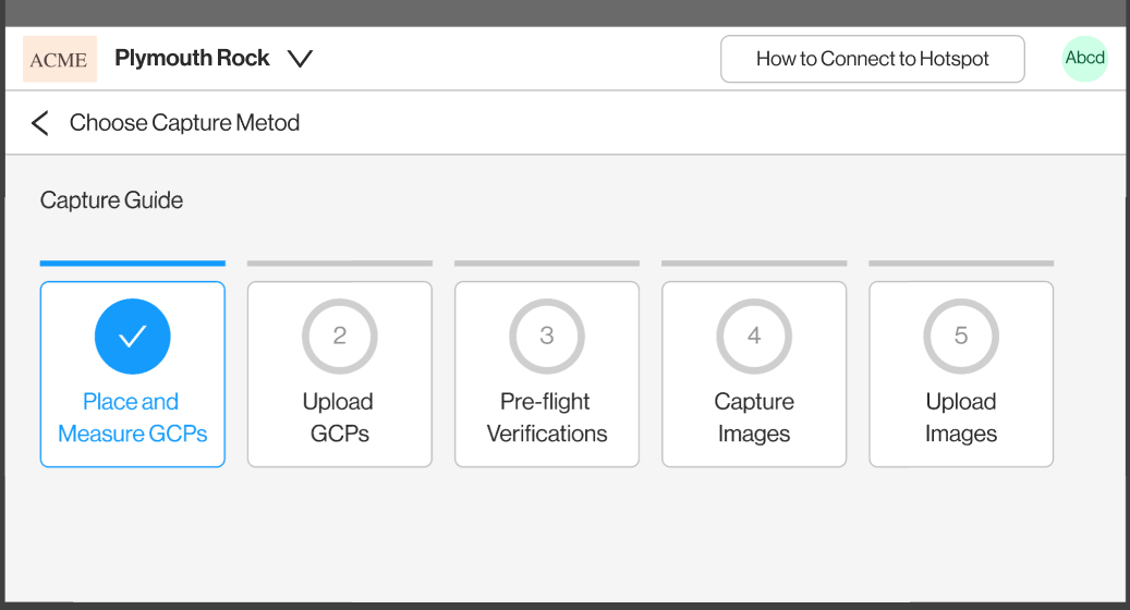
After transferring the file, return to the CaptureApp and Select Step 2: Upload GCPs
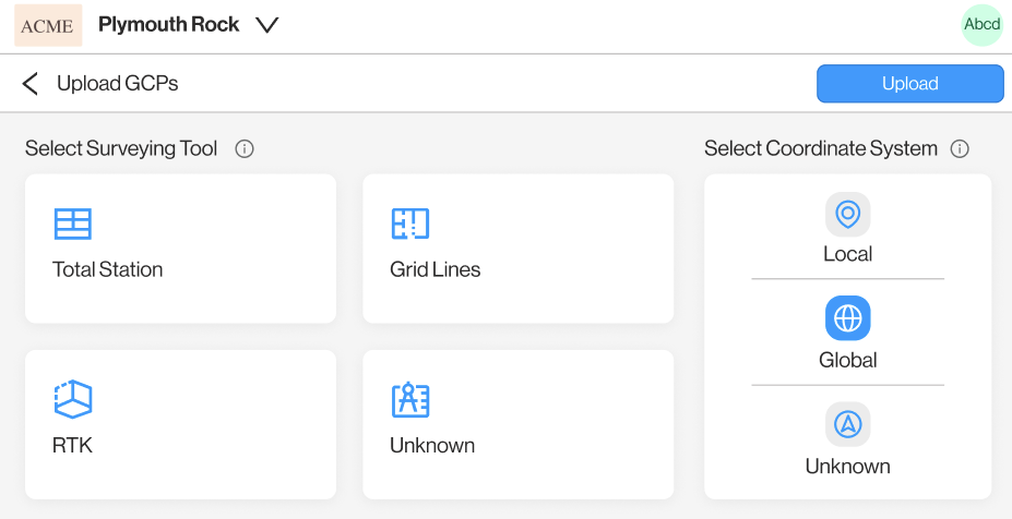
and then select the measurement tool and coordinate system to transfer the GCPs to Siteaware.
Via the Self-Capture Upload Portal
When clicking Choose File a pop-up will open. Clicking Choose File will open the file browser allowing the user to select the GCP file(s).
Any file format is accepted
The user will be asked to choose a measurement type and coordinate system
Measurement Type Definitions:
Total Station- The points were measured with a Total Station.
RTK - The points were measured with a GPS-based measuring tool.
Gridlines - The points were placed at a designated offset fro.m the control grids (i.e. 1’ x 1’ SE off of Col A1).
Unknown - It is unknown how the coordinates were measured.
Coordinate System Definitions:
Local - The points were measured in a project-specific coordinate system (i.e. Based on A1 being 1000,1000)
Global - The points were measured in a WGS coordinate system (Coordinates will be similar to 7255917.330,2542665.775)
Unknown - It is unknown what coordinate system was used to measure the coordinates.
After the upload is complete, the files will appear in the table.